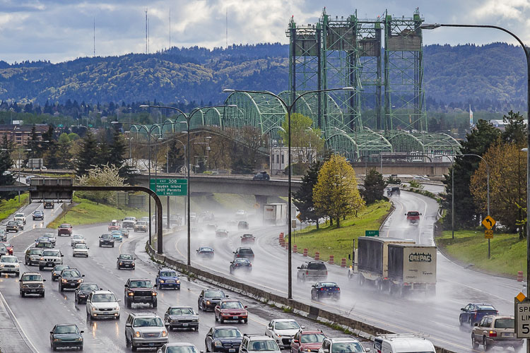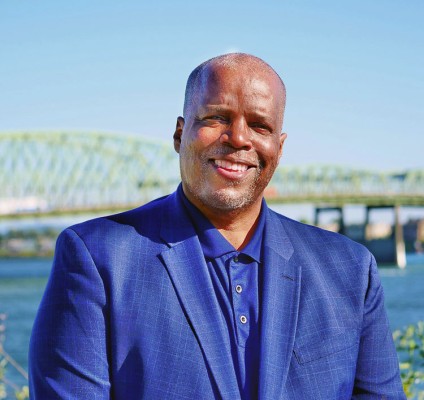
Interstate Bridge Replacement Program Administrator Greg Johnson addresses questions about the status of the process to replace the I-5 Bridge
Greg Johnson, administrator
Interstate Bridge Replacement Program
Following the recent U.S. Coast Guard Preliminary Navigation Clearance Determination there has been confusion and misleading information conveyed regarding the Interstate Bridge Replacement (IBR) program. This includes technical inaccuracies like the potential height and grade of a replacement bridge, the types of moveable spans under consideration, and the misconception that a tunnel is a feasible alternative.

It’s a lot to cover, so let’s start with the Preliminary Navigation Clearance Determination. Last month, the U.S. Coast Guard shared its preliminary determination stating that the current vertical clearance of 178 feet should be maintained. It is crucial to understand that this preliminary determination does not constitute an approval or final agency determination. We know that a bridge with a higher vertical clearance or moveable span could pose other challenges that will need to be considered such as airspace restrictions, grade requirements, and connections for freight, transit, and active transportation. There is a long way to go in this process, and we are committed to continue working closely with the Coast Guard and other federal partners over the next several years to identify a solution that best accommodates river navigation while balancing the needs of other modes, including freight, automobiles, bicyclists, pedestrians, transit, and aviation.
To meet Coast Guard requirements, can the IBR program just design the new bridge with a moveable lift span identical in specification to the current lift span? The simple answer is no. While the existing horizontal navigation clearance is 263 feet, initial conversations with the U.S. Army Corps of Engineers suggest they are likely to require a navigation channel that is a minimum of 300 feet wide to meet the authorized channel width, along with an additional 50 feet on each side for channel maintenance. A 400-foot horizontal clearance in the main navigation channel would require a moveable span possibly up to 575 feet in length.
To put it into perspective, whether we are looking at a lift bridge, a swing bridge, or a bascule bridge, a moveable span of this size would be one of – or even the largest – moveable spans in the world. For example, a bascule bridge (or drawbridge) would need to have two sections that lift (known as a double leaf design) to accommodate this horizontal navigation clearance and would be the widest such bascule design in the world by a good margin. By comparison, the largest double leaf bascule structures currently are the Market Street Bridge in Chattanooga, Tenn., with 358-feet of horizontal clearance, the Eire Avenue Bridge in Ohio, with 339 feet, and the Rethe Bridge in Germany with 310 feet. Locally, Portland’s Willamette River bridges that use a double leaf bascule design include the Morrison Bridge with 284 feet of horizontal clearance, the Burnside Bridge with 252 feet and the Broadway Bridge with 278 feet.
There are certain things where you want to be the biggest, but a complex moveable bridge span is not one of them. Not only is a moveable span likely close to a half-billion dollars more costly to build than a fixed span, adding moveable parts to a bridge adds many challenges such as additional joints that can impact transit, unreliability in extreme weather, continued safety and congestion issues as a result of bridge openings, as well as higher operations and maintenance costs for the life of the bridge. In the coming months, the program will complete an assessment that examines the tradeoffs of different moveable span options in more detail as we continue our work with the Coast Guard.
Will a new bridge built higher than the current span (without a bridge lift in effect) be too steep for light rail transit, freight, and active transportation? No. While the replacement bridge has not been designed and final road grades have not been confirmed, the previous planning effort identified a grade of just under 4% for a 116-foot vertical clearance. It is not unusual to have highway grades at 4% or steeper, which is considered safe when designed with sufficient space for vehicle drivers to see far enough ahead and react to traffic. A 4% grade also meets the Americans with Disabilities Act and Public Right of Way Accessibility Guidelines, which specify a maximum 5% grade for pedestrian facilities. A 4% grade on the short, half-mile length of grade on a replacement bridge also would not be expected to create issues with braking for freight haulers or other drivers. As work continues, the program will identify a design that accounts for the safety of all multimodal travelers and adheres to interstate and freeway safety standards.
So, what about costs? Is the program really trying to keep the real cost of the bridge a secret until later in the process? Once again, the simple answer is “no.” At the direction of the Washington State Legislature, the program completed a preliminary Conceptual Finance Plan and cost estimate range in December 2020. Given the endorsement of the Modified Locally Preferred Alternative (LPA) by our local partners, the IBR program will now be able to continue to refine cost estimates, provide an updated cost analysis, and identify and address cost escalation risks.
Would project phasing save on the overall program cost? No, quite the opposite. Phasing would contribute significantly to cost escalation over time and would impede the ability to receive federal infrastructure grants and approvals. Further, standalone projects delayed to a future undetermined date would result in not addressing current transportation problems identified in this corridor and would harm the ability of a multimodal corridor to operate effectively. Finally, phasing would multiply the number of years the program area would be under construction.
Why not build a tunnel instead of a bridge? Along with extensive studies related to this alternative during the prior project, this concept has been thoroughly studied by the IBR program and rejected as a suitable option for many reasons. These include cost, the environmental and archeological impacts of dredging, the loss of highway connections on either side of the river, the impact to transit and active transportation, the need to construct extremely large fabrication facilities specifically for the project, and more.
What about congestion relief? Some have claimed the IBR program will exacerbate congestion and increase travel times. This is false. Compared to doing nothing, our best modeling suggests that the addition of one auxiliary lane in each direction is projected to increase safety and reliability for drivers on this route, while shaving three minutes off southbound morning commutes and 11 minutes off northbound evening commutes. Without a replacement bridge it is expected that congestion would greatly increase over the next two decades from today’s levels. Additionally, the new bridge will provide travel options that will encourage a shift in travel modes.
The IBR program is not starting from scratch. There has been clear direction from both states that the program should utilize past work from the previous project that remains valid, while also taking into consideration changes that have occurred. Decades of work went into identifying constraints within the corridor and analyzing multiple alternatives to identify how to best meet our region’s transportation needs. This resulted in the LPA that was approved in the former Record of Decision (ROD). We are maximizing the past investment to ensure efficient decision-making.
Restarting the alternatives analysis process and studying multiple distinct alternatives would constitute a new National Environmental Protection Act (NEPA) process. This would add significant time and cost to the effort with the likelihood that we would end up with a similar outcome, given the fact that the same transportation problems that were previously identified still must be addressed. Restarting the NEPA process would also impact our ability to access federal funding made available through President Biden’s historic infrastructure legislation. Naturally, we are striving to avoid such an outcome by identifying the best possible bridge solution from the beginning.
So, which elements of the Modified LPA can change, either during or after the NEPA process? The Modified LPA defines the foundational elements that will be evaluated and are only a starting point for the next phase of our work with the Federal Highway Administration (FHWA) and Federal Transit Administration (FTA), which oversee the NEPA process. All elements of the Modified LPA can be refined during the NEPA process as additional details are discovered and the design progresses. The NEPA process will further include numerous additional studies and the opportunity for community input.
While we will never be able to identify a perfect solution that all stakeholders agree is the best possible design, we know a vast improvement from the current bridge is within our reach. It is our responsibility to identify a multimodal solution that best balances the needs and priorities of all travelers now and into the future. We are confident that our continued collaborative process with our regional and federal partners, along with robust community input, will result in a multimodal replacement bridge that will serve communities on both sides of the Columbia River for the next 100 years.
Also read:
- Delays expected on Northwest 99th Street during water quality project constructionClark County will begin construction in July to install a stormwater filter vault on NW 99th Street. Drivers can expect delays, but lanes will remain open during the work.
- POLL: What’s the biggest concern you have with the current I-5 Bridge replacement plan?As costs rise and Oregon’s funding fails, concerns mount over the current I-5 Bridge replacement plan. Clark County Today asks readers: what’s your biggest concern?
- Plan ahead for ramp closures on I-5 near Ridgefield, July 8-9Travelers on northbound I-5 near Ridgefield should prepare for ramp closures July 8–9 as WSDOT crews conduct final testing of new wrong-way driving detection systems. The closures affect exits 9 and 11, including the Gee Creek Rest Area.
- Oregon DOT director calls transportation funding bill failure ‘shocking,’ warns of layoffsODOT Director Kris Strickler warned staff that up to 700 layoffs are imminent after lawmakers failed to pass a transportation funding bill, deepening the agency’s $300 million shortfall.
- New crossing opens over SR 500 in VancouverWSDOT has opened a new pedestrian and bike bridge over SR 500 in Vancouver, restoring direct and ADA-accessible access for people walking, biking, or rolling.


