

The storm could bring up to two inches of rain through Tuesday afternoon
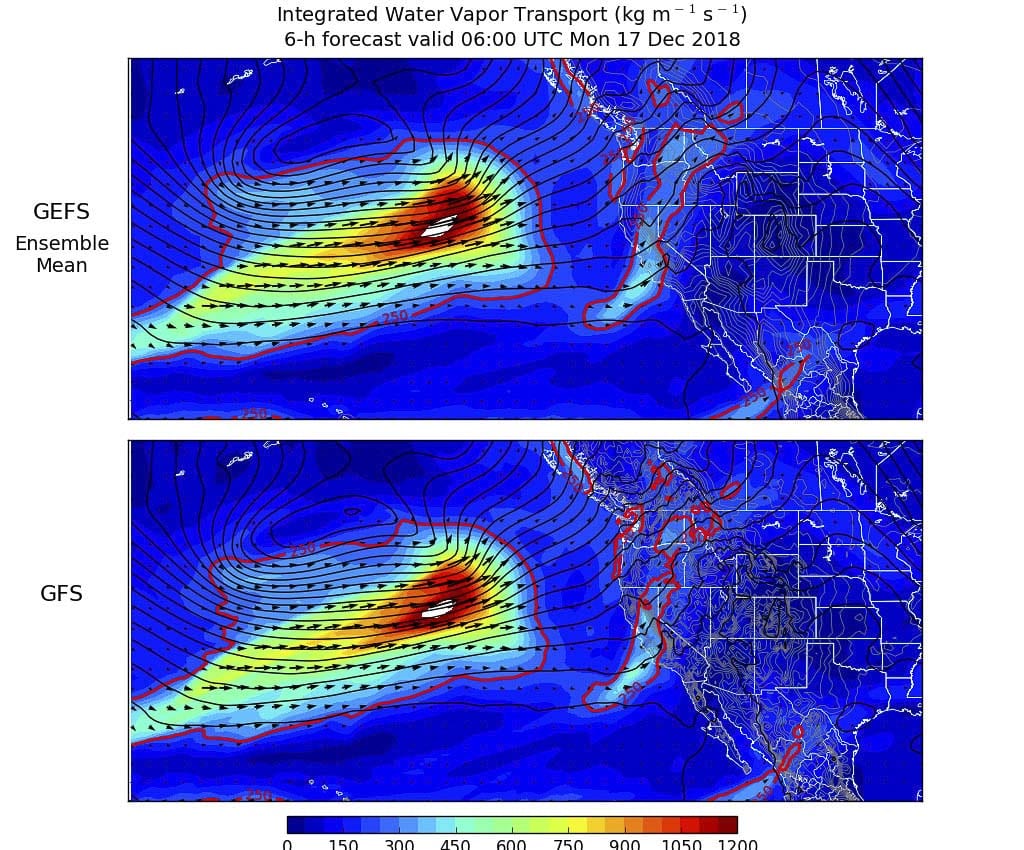
CLARK COUNTY — A strong storm system is taking aim at the Pacific Northwest, expected to bring high winds and drenching rain, and make a mess of your Tuesday morning commute.
“Looks like there could be anywhere from 1.5-2 inches through tomorrow afternoon,” says Jeremiah Pyle, a meteorologist with the National Weather Service in Portland. “Up into some of the foothills in the eastern parts of the county it could be even higher, maybe two to four inches. Could be even higher than that.”
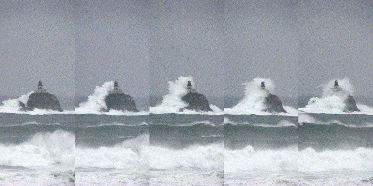
The North Oregon and Southern Washington coastlines are expected to get hit especially hard, with winds gusts up to 70 miles an hour, and up to six inches of rain. That could lead to flooding along some coastal rivers, as well as some streams in the Willamette Valley.
Pyle says this will be a warmer system, raising snow levels well above the ski lodges through tomorrow. Timberline has already announced that they will be closed on Tuesday due to the rain and high winds.
In the city, people are being urged to check storm drains to make sure they’re clear of debris. Power crews will also have extra people on standby to deal with outages due to downed trees.
One of the biggest impacts of this storm could be the Tuesday morning commute.
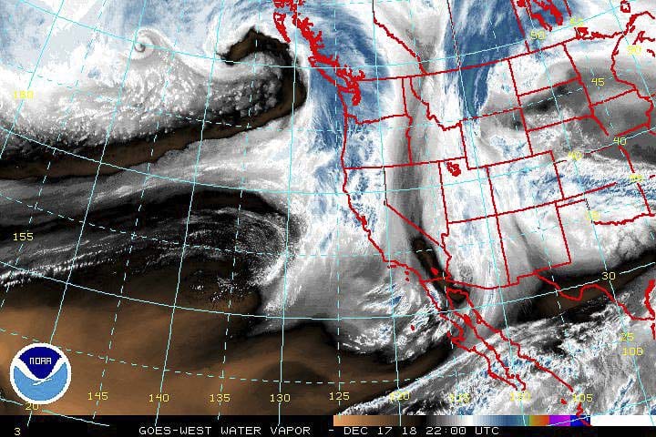
“It looks like the main frontal band of this system will be moving over the area sometime between 4 a.m. and 10 a.m. tomorrow,” says Pyle, “so we’re kind of trying to give people a head up that we may be seeing some exceptionally heavy rain during that time.”
This system is expected to move through by late Wednesday morning, or early afternoon. Showers will continue, however, and another wet system is expected to move through by Thursday afternoon.
