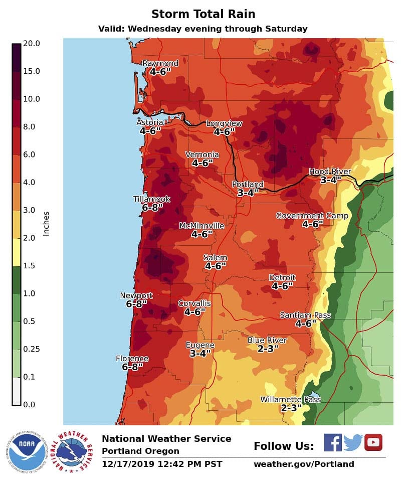
The National Weather Service in Portland is forecasting up to five inches through Saturday
VANCOUVER — Batten down the hatches, check the gutters, and make sure the drains in your street are clear. There’s a soaker headed for the Pacific Northwest.

Starting overnight on Thursday an “atmospheric river” is expected to bring heavy rain to the region, from the central Oregon coast up through Astoria, and points inland, including Clark County.
“Coast and Coast Range we’re looking at anywhere from six to 12 inches,” says Will Ahue with the National Weather Service in Portland. “Some parts in the Coast Range getting as high as maybe 15 or 16 inches.”
Inland, Ahue says we could see anywhere between two and four inches between Thursday night and Saturday afternoon, though some areas could see upwards of six inches.

We do need the rain, Ahue says, though maybe not all at once. The average rainfall for Portland Airport for the water year, which starts Oct. 1, is 12 inches. As of Wednesday less than five inches had been recorded, despite heavy rainfall late last week.
“Maybe after this storm we’ll be right around normal for what we see this time of the year,” says Ahue, “in terms of the water year.”
The National Weather Service has issued a flood watch for all of Northwest Oregon and Southwest Washington, though Ahue says river levels are low enough currently that they don’t expect major flooding in the Portland-Vancouver area.
The biggest problem will be urban flooding, and the impact on Friday’s morning and afternoon commutes.
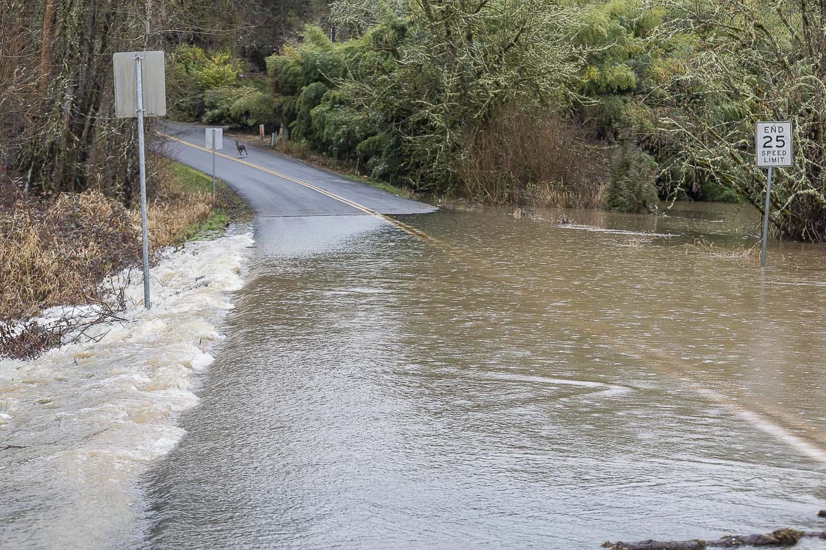
“Uncontrolled rivers in Clark County may see definitely rises,” says Ahue, “and some of them may start spilling out of their banks. But it really all depends on where this rain sets up and for how long it sets up.”
A heavy band of rain could cause urban flooding in streets, he says.
“You dump a whole bucket of water on a concrete floor, you’re going to see some flooding,” says Ahue. “Good news is that most of the drains should be clear, so that should help alleviate some of the issues.”
The city of Washougal sent out a notice on Wednesday advising residents that sand and sandbags are being made available for emergency use from 8 a.m. to 4:30 p.m. at the Public Works Operation Center at 2201 C Street, or the 2300 block of North L Street at 22nd Street.
The other bit of good news is that the storm isn’t expected to bring a major windstorm. The coast could see gusts above 50 MPH, but inland the most we should see is a possible gust near 30 MPH.
“This forecast is going to be changing a lot over the next several days,” warns Ahue. “We recommend you follow us at weather.gov/Portland … or on our social media accounts on Facebook and Twitter.”
Since the atmospheric river flows in from the south Pacific, it’s likely to be warmer. That means that mountain passes and ski areas could see some rain Friday into the weekend, so people hoping for some skiing during their Christmas break could be disappointed.


